This is a photo review of the third day of my four-day trek from Kharangon to Ojuk through the Semiganch Gorge. In the last photo review, I stopped at the moment when I descended from Mount Mushteppa to the village of Dora. In the kishlak, I visited Faiz, reloaded my camera, had a delicious and filling lunch, and rested a bit from the hardships of camp life. Then, I continued along the river in the Semiganch Gorge towards the Kumkayakutal Pass in the Romit region. Once I pass the pass, I'll find myself in the Odjuk Gorge in the Varzob region..
Showing posts with label Hike. Show all posts
Mount Mushtepa, Day 2 of the Hike, is a Ridge Between the Varzob and Ramit Gorges, Mountains of Tajikistan
The second day of my four-day hike was entirely dedicated to Mount Mushtepa. Mount Mushtepa is located on the watershed ridge between the Varzob and Ramit rivers, so on this day, I visited both of them. I began the ascent on the Varzob side in the Harangon River gorge, and by midday, I had reached the summit of Mushtepa before descending to the Ramit side in the Semiganch gorge.
The Harangoni Gorge and Ridge, a One-Day Trek, Varzob, Mountains of Tajikistan
So, I decided to go on a hike, during which I planned to visit places such as the Harangoni Ridge, climb Mount Mushtepa, descend from the mountain into the Semiganch Gorge, and hike through it to the Kumkayakutal Pass. After crossing the pass, I would end up in the Ojuk Gorge and hike through it all the way to the village of Varzob. I fully completed this route plan in four days. This is a photo overview of the first day of the hike.
A Whisper from the Netherworld — A Short Story
The five of them trekked through the gorge alongside a narrow mountain river. The path zigzagged capriciously, and the frequent rocky outcrops often rendered the banks impassable. They had to cross the river again and again, ford its cold currents time after time. But no one complained. These were wild, uninhabited lands—who would build bridges here? And that was precisely what they had wanted: to get as far away as possible, into the deepest backcountry. So, they all jumped across the slippery stones with enthusiasm, conquering each watery obstacle.
Hiking to the Peak of Gushor, Varzob Gorge, Mountains of Tajikistan
The peak of Gushor is well visible from any point in Dushanbe. I have been planning to climb it for a long time, and finally I did it. The mountain, or rather the peak of Gushor, is one of the peaks that crown the Chilikak ridge. This ridge stretches from the Varzob River (approximately 16-21 kilometers from the Varzob highway) to the Luchob River in the area of the village of Shiratalo. The Gushor peak (2450 meters) is not the highest point of the Chilikak ridge; there is another peak with a weather station above it (2552 meters), another unnamed peak (2606 meters), and the highest point, the Chilokak peak (2702 meters), which is already closer to Shiratalo and cannot be seen from the city.
Hiking to the Waterfalls in Voru Gorge, Odzhuk, Varzob, Mountains of Tajikistan
How to Quickly Start a Fire on a Hike Without Firestarter
When you go on a short hike or a picnic, you might run into a situation: you have firewood, you have matches or a lighter, but you have no firestarter. All your food is packed in plastic bags, and you don’t even have a newspaper.
Hiking the Odzhuk Circuit, Varzob, mountains of Tajikistan
I completed a solo trek along the Odzhuk loop. The route, as the name suggests, passes through the Odzhuk gorge in Varzob, Tajikistan. To complete this route, one must hike through the entire Odzhuk gorge up to the Kichkine pass, then traverse the plateau to the Childukhtarun pass and descend back into Odzhuk. Ideally, this route can be completed in two days with one overnight stay, but since I was alone and taking my time, climbing and taking photos wherever I could, my trek took three days and two nights.
Hiking from Begar Gorge to Odjuk Along the Ridge Between Takob and Odjuk, Varzob, Mountains of Tajikistan
Spontaneous hike, when it was offered to me, I didn't really know where we would end up or how we would get there. Despite the uncertainty, the hike turned out to be very successful. There were a lot of impressions, first of all, intriguing old mine tunnels at the beginning of the hike. Secondly, it was very interesting to walk along the watershed ridge, looking down at the gorges that I had already walked through many times at the bottom.
Camping Light from a Phone and a Water Bottle
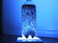
On a camping trip — or even at home when the power goes out — you might need some decent lighting. Everyone has a flashlight on their phone, but holding it in your hand isn’t always convenient. You just want the light to be there, illuminating the space around you. That’s useful both in the wilderness and in the city.
Hike to Adit in the Beggar Gorge, Varzob, Mountains of Tajikistan
We decided to hike from the Beggar gorge to the Ojuk gorge and wander around the ridge separating them. During this hike, we stumbled upon abandoned mines in the Beggar gorge. These abandoned mines, where fluorite used to be extracted, seemed interesting to me, so I decided to dedicate a separate photo review to them. I have already come across old mines in the Varzob gorge. Just this year, I did a photo review of such a hike, which can be viewed here if anyone is interested.".
Hike in the Arg Gorge, near Lake Iskanderkul, Fann Mountains, Tajikistan
In the Fan Mountains of Tajikistan, near Iskanderkul Lake, there is a river called Arg, which gives its name to the gorge. The Arg River is a tributary of the Sarytag River and one of the rivers that feeds Iskanderkul Lake. We were interested specifically in the Arg River, which is sometimes spelled ArX on maps, but I am more accustomed to ArG. We drove from the "Iskanderkul" tourist base to a fork in the road and continued on foot. From the beginning of the gorge, where the Arg River flows into the Sarytag, it was about four kilometers to the area we were interested in.
Spring Hike to the Waterfalls in Gusgarf, Varzob Gorge, Mountains of Tajikistan
I can't say exactly how many waterfalls there are in Gusgarf, but the most famous ones are two waterfalls: "Pioneer" and "Eagle's Nests". Well, officially, these waterfalls are called the Big Gusgarf Waterfall and the Echo Waterfall, respectively. However, I have been to these waterfalls even three times, as I found another one, let's say, unnamed but quite decent waterfall. I visited these waterfalls at different times, and it was interesting to see how these waterfalls look in spring, when there is a lot of water. So, when spring came, I went to see the waterfalls in Gusgarf.
Alone in the Mountains
In one of my previous posts, I apparently didn't express myself very clearly about hiking in the mountains alone. Some readers assumed it was a forced circumstance and started encouraging me, saying things like, "Don't worry, things will work out, you'll find company eventually."
Hiking to Childukhtaron Pass, Odzhuk Gorge, Varzob, Mountains of Tajikistan
The elongated canyon along the Odzhuk River begins from the Varzob highway, or from the Varzob River if you will. The canyon has many branches that lead to Begar, Kharangon, and Chayka. The official end of the Odzhuk canyon is considered to be the Childukhtar, Kichkine, and Kumkayakutal passes. The first two passes lead to a high mountain plateau with Takoba tributaries, respectively, beyond which lies the Takob canyon. The Kumkayakutal pass leads to the mouth of the Semiganch River, a tributary of the Romit River, and thus to the Romit canyon.
That Time «Something Went Wrong» — A Short Story
Long before I finally set out on this hike, people kept asking me, "Have you been to the Gusgarf Waterfall?" "No," I'd reply, "what waterfall is that?" The descriptions that followed were always colorful, but they all boiled down to the same thing: it was a big one, about thirty meters high, and back in Soviet times it was called "Pionersky" (The Pioneer). Lately, I'd heard another name too — "Ok Kul" — though I can't vouch for that one.
Anatomy of Mountain Boots: From Hiking to Mountaineering
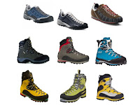
When choosing gear for a mountain hike, special attention should be paid to a few key items. Footwear is one of them. What you put on your feet determines whether your trip becomes a painful struggle against discomfort or an adventure where nothing distracts you from the beauty around you. Blisters, sore feet, wet socks—all are consequences of poorly chosen boots.
Hike to the Adit in Odjuk Gorge, Varzob, Mountains of Tajikistan
I was always amazed at why there was such a good, wide path in Odzhuk that went almost all the way through the canyon. It turned out to be an old dirt road that led to an abandoned mine where they mined or searched for something like fluorite until 1947. There are many such abandoned mines in the vicinity. Apparently, they dug and searched, but didn't find anything significant and abandoned them. Industrial fluorite mining may still be taking place in the Takob and Magof valleys, not far from here. Locals also call these mines quartz, but quartz is just a accompanying mineral of fluorite and is not of interest for development and mining, at least not the local variety.
A Ring for a Solo Hiker — A Short Story
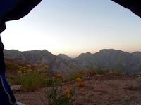
People usually go hiking in groups — it's more fun and safer. But there are exceptions to this rule. There's such a thing as solo hiking, where being alone in the mountains is a conscious choice, not a forced situation. Everyone has their own reasons, and it applies to all kinds of mountain travel. There are even climbers who summit peaks alone — that's a solo ascent. The phenomenon isn't new; it's just not very common. In the Soviet past, for example, such individualism wasn't encouraged, so it's more developed in the West.
Anatomy of a Hiking Backpack: Types, Designs, and Purpose
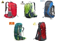
A backpack is the first thing that comes to mind when you think of hiking. It doesn’t matter whether you’re heading to the mountains, the forest, a long journey, or just a city sightseeing tour. Nothing better has been invented for carrying your gear, so backpacks are used literally everywhere: school, work, daily commutes, walks. As a result, the market is flooded with options, and it’s worth knowing which backpack to take where.
Popular Posts
-
The Siyoma River Gorge is situated 54 kilometers along the Varzob highway, almost directly opposite the Varzob Climbing Camp. It is a popula...
-
≪ to the previous chapter Surprisingly, Luka didn't show up right away. A couple of weeks later, I visited the snow people's settl...
-
Decided to take a walk to the hills behind Victory Park. Overall, the hike didn't go very well, I chose the wrong time, didn't equi...
-
In the previous articles of this series, we talked about why solitude in the mountains is a conscious choice, went over general safety rule...
-
I had known about this waterfall for a long time, but I never managed to see it. The thing is, the waterfall can only be seen in the spring...
-
≪ to the previous chapter I woke in the morning, rose from the bed, and felt literally overflowing with energy. It seemed if I jumped, I m...
-
Many beginners haunt their own imaginations with grisly scenes: hungry wolves lying in ambush or a bear specifically stalking a tourist aro...


