≪ to the previous chapter
After descending a bit lower, I found a cozy little clearing. It was warmer here. I decided to rest and figure out my route. I transformed, took out my phone to look at the maps, and saw—a missed call from Shams. I called him back immediately.
Above Only the Sky: The Story of the First Ascent of Everest
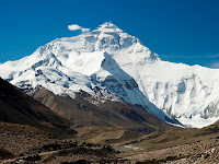
The highest of all peaks, the loftiest point on Earth — Mount Everest. Its official name was given in honour of Major George Everest, head of the Trigonometrical Survey of India. Some say he was a governor, but that’s a myth. The irony? This gentleman never accomplished anything extraordinary and was just a high-ranking official. Yet the mountain bears his name.
All Ten Bridges in the Odjuk Gorge, Varzob, Mountains of Tajikistan
On the last day of my hike, I trekked through the Odjuk Gorge from the Kumkayakutal Pass to the village of Varzob. I took this opportunity to dedicate a photo review to the ten bridges that now span the gorge. Previously known as the "Gorge of the Seven Bridges" among tourists, the presence of these ten bridges is a welcome sight compared to the Semiganch Gorge, where no bridges exist, and I had to jump over stones to cross the river.
Chapter 6: The Curse of the Circle of Darkness from Bear Metamorphoses
≪ to the previous chapter
Judging by the tracks, the Englishman, possessed by the jondor, after crossing the ridge, didn't descend but turned west. The altitude here, by the way, was considerable. A snow-covered section ran along the ridge's edge. After passing it, he turned. His path ran below the snow line but was still high up. Given how fast he was moving, one could only marvel at the Englishman's physical conditioning, whose name, incidentally, I still hadn't bothered to learn. If he continued like this without changing direction, he would eventually come out to a section of the highway between Ishkashim and Khorog. That road also ran along the border. Surely he wasn't going back to Afghanistan? That would be too much!
The Sandal on the Pamir: A Legend of Bodhidharma
Who Was Bodhidharma? Bodhidharma was the first patriarch of the Chan Buddhist tradition (known in Japan as Zen). He is also called Damo, Daruma, and… the Bearded Barbarian. The last nickname came about naturally. Unlike the clean-shaven Chinese monks, he wore a beard. Moreover, according to legend, he came to preach his teaching in China from India. And the Chinese called all outsiders “barbarians” – hu. Hence “the Bearded Barbarian.”
Kumkayakutal Pass, 3-Day Hike, Semiganch Gorge, Romit, Mountains of Tajikistan
This is a photo review of the third day of my four-day trek from Kharangon to Ojuk through the Semiganch Gorge. In the last photo review, I stopped at the moment when I descended from Mount Mushteppa to the village of Dora. In the kishlak, I visited Faiz, reloaded my camera, had a delicious and filling lunch, and rested a bit from the hardships of camp life. Then, I continued along the river in the Semiganch Gorge towards the Kumkayakutal Pass in the Romit region. Once I pass the pass, I'll find myself in the Odjuk Gorge in the Varzob region..
Chapter 5: Back Across the Panj from Bear Metamorphoses
≪ to the previous chapter
It became clear I wouldn't catch the group before they crossed the river and the border. The road from the Panjshir Gorge came out to the Panj River opposite Ishkashim. The Englishmen had turned right and driven along the Afghan bank towards Khandud. Theoretically, they could now cross at any point—they just needed to ford the river. But logically, they would wait for darkness. They didn't just need to cross; they needed to go somewhere further. Bek said they had taken mountain equipment, meaning they might be heading into the mountains. They could enter the mountains in numerous places, provided they knew them. And they did know—they had a guide.
The Pamir Mountains: The Origin of the Name and Other Interesting Facts
The Pamir mountain system forms a unique planetary junction, where the spurs of Asia's greatest ranges—the Hindu Kush, Tien Shan, Karakoram, and Kunlun—converge. This grand uplift of the Earth's crust neighbors deep depressions, such as the Tarim (Kashgar) Basin. The Pamir is located at the crossroads of several nations: Tajikistan, China, Afghanistan, and Pakistan. However, its central, highest part, containing the main peaks, lies within the Gorno-Badakhshan Autonomous Region of the Republic of Tajikistan.
Mount Mushtepa, Day 2 of the Hike, is a Ridge Between the Varzob and Ramit Gorges, Mountains of Tajikistan
The second day of my four-day hike was entirely dedicated to Mount Mushtepa. Mount Mushtepa is located on the watershed ridge between the Varzob and Ramit rivers, so on this day, I visited both of them. I began the ascent on the Varzob side in the Harangon River gorge, and by midday, I had reached the summit of Mushtepa before descending to the Ramit side in the Semiganch gorge.
Chapter 4: On Chicken Street in Kabul from Bear Metamorphoses
≪ to the previous chapter
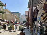
On the Afghan side of the Panj, just like on the Tajik side, there was a small settlement near the bridge. To avoid being seen, I didn't approach it but immediately headed towards the road. Of the main roads, only one led south from the bridge—first to Kunduz, and then on to Kabul. I ran alongside this road, not getting too close, but not losing sight of it either.
Popular Posts
-
The Siyoma River Gorge is situated 54 kilometers along the Varzob highway, almost directly opposite the Varzob Climbing Camp. It is a popula...
-
In the previous articles of this series, we talked about why solitude in the mountains is a conscious choice, went over general safety rule...
-
I had known about this waterfall for a long time, but I never managed to see it. The thing is, the waterfall can only be seen in the spring...
-
≪ to the previous chapter Surprisingly, Luka didn't show up right away. A couple of weeks later, I visited the snow people's settl...
-
Decided to take a walk to the hills behind Victory Park. Overall, the hike didn't go very well, I chose the wrong time, didn't equi...
-
The Pamir mountain system forms a unique planetary junction, where the spurs of Asia's greatest ranges—the Hindu Kush, Tien Shan, Kara...
-
Imagine the worst‑case scenario: you’re alone in the mountains. You get caught in a prolonged downpour, a mudslide sweeps down, or you simp...